cramlington masterplan
Strategische Leitplanung für Frei- und Stadträume // Cramlington,Northumberland, UK // 2014
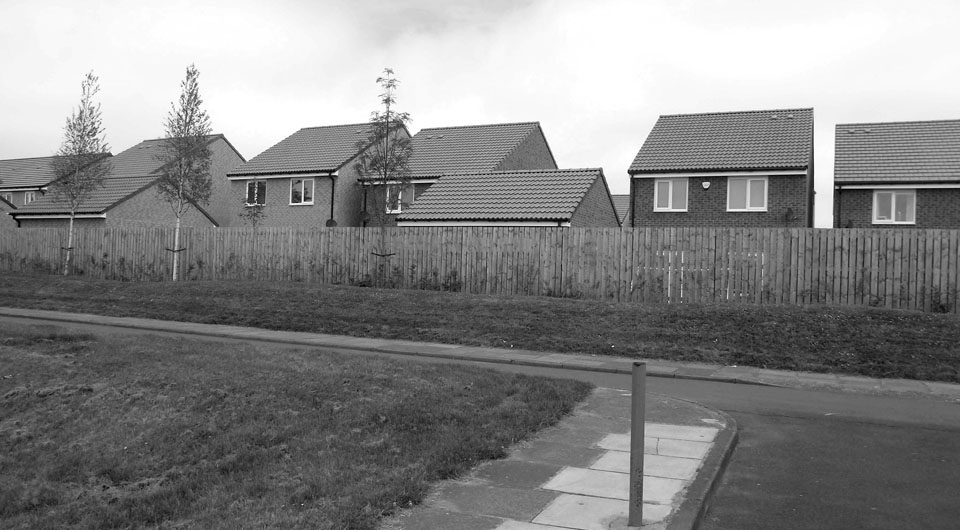
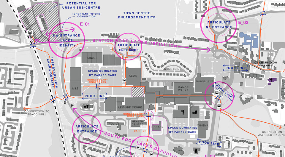
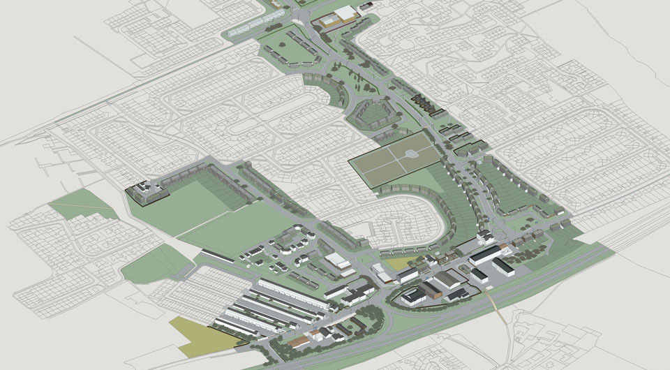

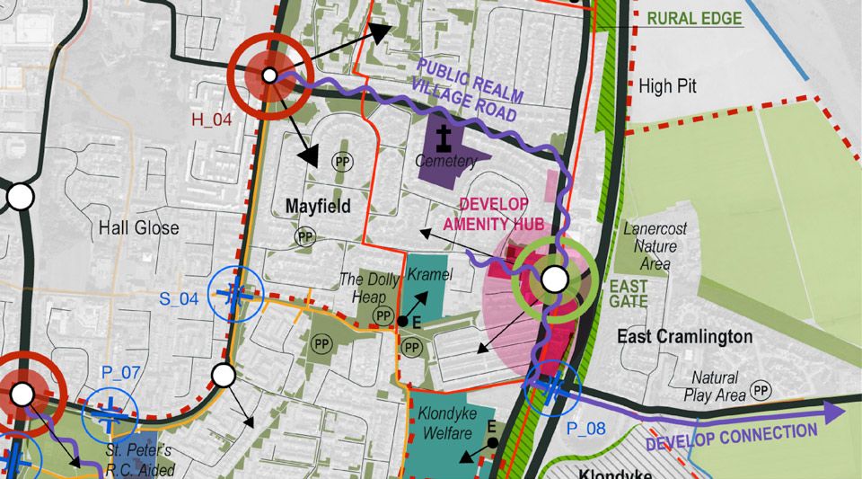
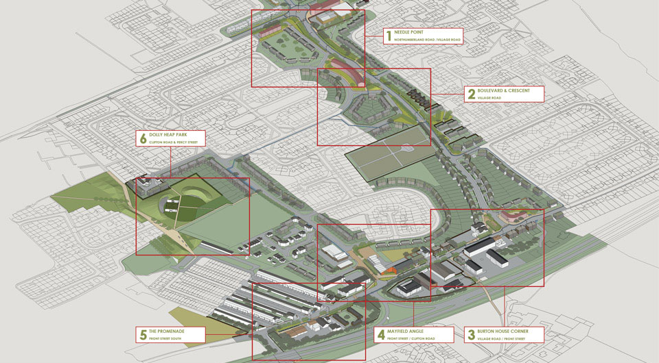
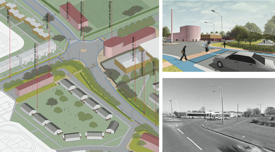

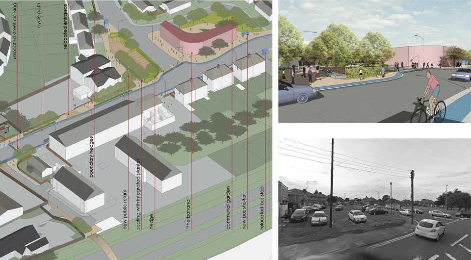
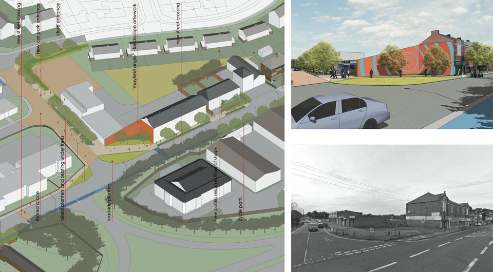
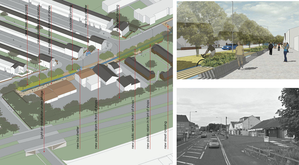
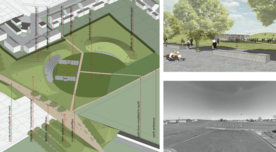
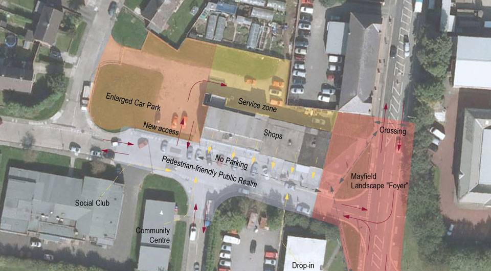
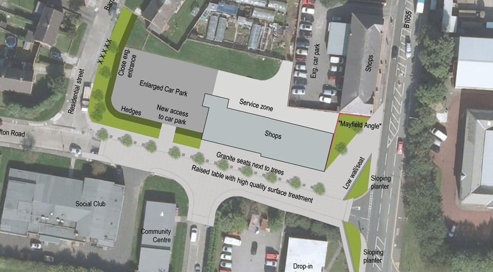
Cramlington is coming of age. It is a prosperous, attractive and growing town whose position adjacent to the two main roads into Northumberland and on the East Coast Main Line makes it a „Gateway to Northumberland”. The generous integrated green space within the town’s built form is understood as the point of departure for the transformation of Cramlington into a contemporary Garden Town, with a verdant, healthy and well used landscape structure, and a major driver for Cramlington’s growth.
In our strategy, a set of key principles inform specific proposals to improve the landscape and townscape of Cramlington. They derive from the Vision for Cramlington as Northumberland’s first contemporary garden town.
These principles are:
Bringing the countryside into the town, Legible Cramlington, A Coherent Town Centre, Respect the Past, Look to the Future, Actions not words -Cultural/Sport/Civic mobilisation , Each District a Place, Residential Identity, Access all Areas, Pedestrians and bicycles first, Quality not Quantity, Targeted Public Realm improvements, This Land is your Land, Access to the countryside, Don’t ignore, Repair,Tackling problem areas head-on
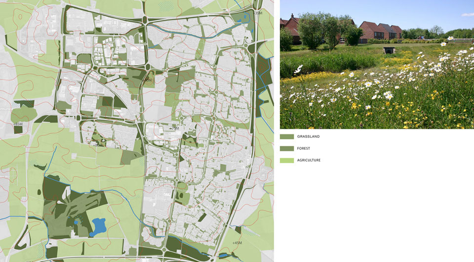
One of Cramlington’s great strengths is the proximity and immediacy of the rural landscape. One has only to pass over (or under) the outer grid of roads to be in a true rural landscape: Cramlington has no suburbs, and the rural landscape is one that contains many attractive recreational areas. The reclamation of the former scars of deep and open-cast mining has created a pattern of woodland, wetlands and nature reserves, accessible via an extensive network of public rights of way.
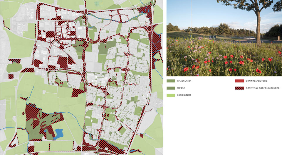
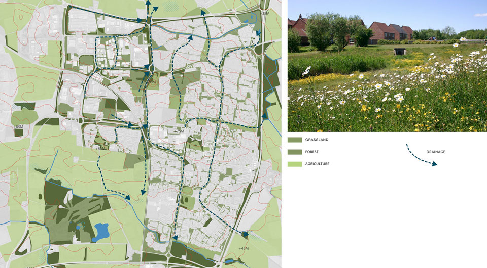
By examining these networks and connections, together with the town’s topography and the proposed landscape interventions, we have identified a potential ecological matrix connecting the town and its surroundings. By developing the landscape, surface water drainage and paths and roads as a symbiotic whole, a broad ecological potential can be identified in the town’s deep structure, the armature for a sustainable future.
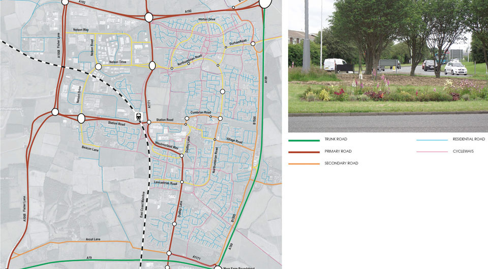
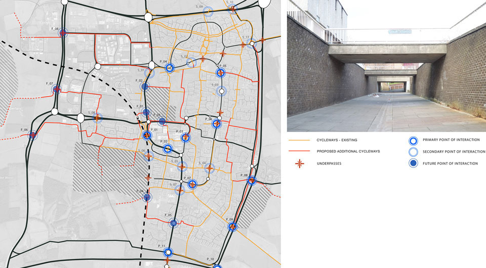
Cramlington has an extensive network of pedestrian and cycle infrastructure, largely separate from its road network, running through public green spaces and connected across the roads with underpasses. This system enables pedestrian to move around the town easily and the associated green spaces are an important civic, ecological and bioclimatic asset. But the resulting lack of interaction with other forms of traffic is disproportionate to traffic loads and the prevailing speed limits. Crossing point locations (for underpasses, bus-stops and the like) are generally close to roundabouts where traffic speeds are further reduced. Despite there being few dedicated crossings or even pavement provision in most circumstances, it is evident that many people prefer to cross roads at grade than through the sunken and often desolate underpasses. Bus stops on major traffic routes, often located close to major junctions, are also unwelcoming, often difficult to find, and in some cases can only be accessed using stairs.
The town needs to allow pedestrians to go where they want to and in safety. We propose a series of alterations at strategic points to explore a more inclusive, shared and interactive public realm, creating an active streetscape and aiding orientation.
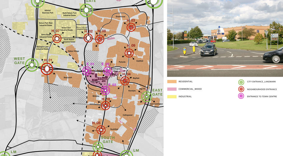
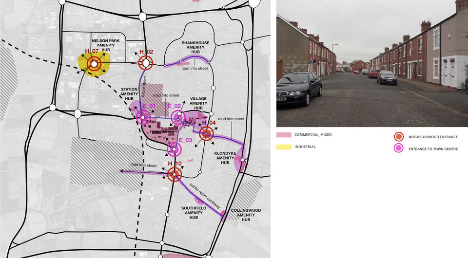
There are now a total of eleven residential districts with more to be created in the southwest sector development, each representative of the time it was constructed. They are generally entered off major junctions with extensive landscaped surroundings, often at roundabouts. These are important orientation points in the town, places when you need to know you have arrived somewhere, or are entering a specific place, slowing down, approaching a destination or otherwise taking your bearings. Traditionally, they would be the locations of landmarks or significant, notable urban elements, helping people to know where they are and where they are going (“Turn left at the King’s Head”). But in Cramlington, such locations are generally homogenous, undifferentiated, and lacking in character, landmarks or any other element that could assist orientation or otherwise positively contribute to the urban experience. We propose that each residential district have its own distinctive entrance and accessible open space and that other landmark „Gateways“ are developed at strategic entrance and orientation points through the town, to improve legibility, and create urban diversity and identity.
Bauherr: Cramlington Town Council // Zusammenarbeit: Robinson Landscape Design (Landschaftsarchitekten) //
